https://youtu.be/6bKYC-FKULg
steveamie.com
steveamie.com
https://youtu.be/6bKYC-FKULg
https://youtu.be/4axsZvJPrX0
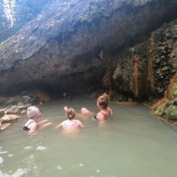
Umpqua Hot Springs is well worth the trip off the main drag near Bend, Oregon. Multiple pools sit on top of a steep cliff overlooking the freezing river below. Umpqua…
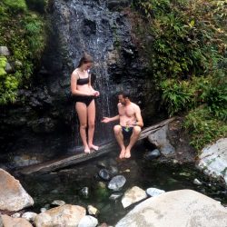
Access to Sloquet is an adventure of a drive, 3 hours or so on a bumpy forestry road from either Harrison Hot Springs or Pemberton BC and that's if the…
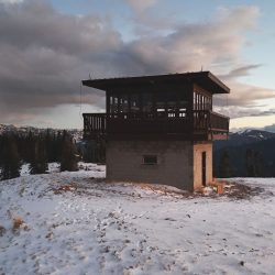
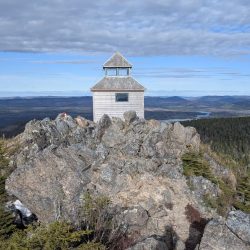
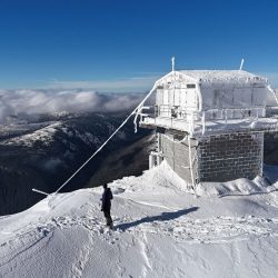
A fire lookout tower on Garnet Mountain in Montana that can be booked for an overnight through the government recreation website. https://youtu.be/Oo_IJheOJXk
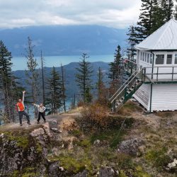
Mt. Hale, an unusual chunk of rock protruding up near the shoreline of Harrison Lake, is one of the destinations along the lengthy forestry road from Harrison Hot Springs toward…
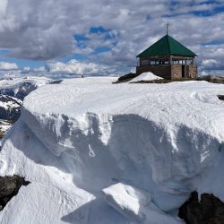
Bluejoint Mountain can be accessed north of Grand Forks, BC. It is located in the Granby river valley. Bluejoint Mountain Summit There is an unpaved road to the top of…

A seldom visited trail in EC Manning Provincial Park, BC https://youtu.be/QEgtlVgYu74

A fairly short bushwhack off the Monument 83 trail (or even shorter up a logging spur near the Pasayten River) Chuwanten Summit https://youtu.be/QEgtlVgYu74

A fantastic hike near Rossland, BC.