From the high-point of Hwy 97 from Kelowna to Vernon look right into the valley below. On a clear day, Camel’s Hump stands isolated in the Creighton Valley before a backdrop of the mighty Monashees. We are talking the Bactrian variety here with a hike up to a first hump, a decent into a foresty saddle of sorts in the middle and another hike up a second hump. With various lookouts around the summits, there is a clear view of the Monashee mountains to the east and Vernon to the west.
Directions To Trailhead:
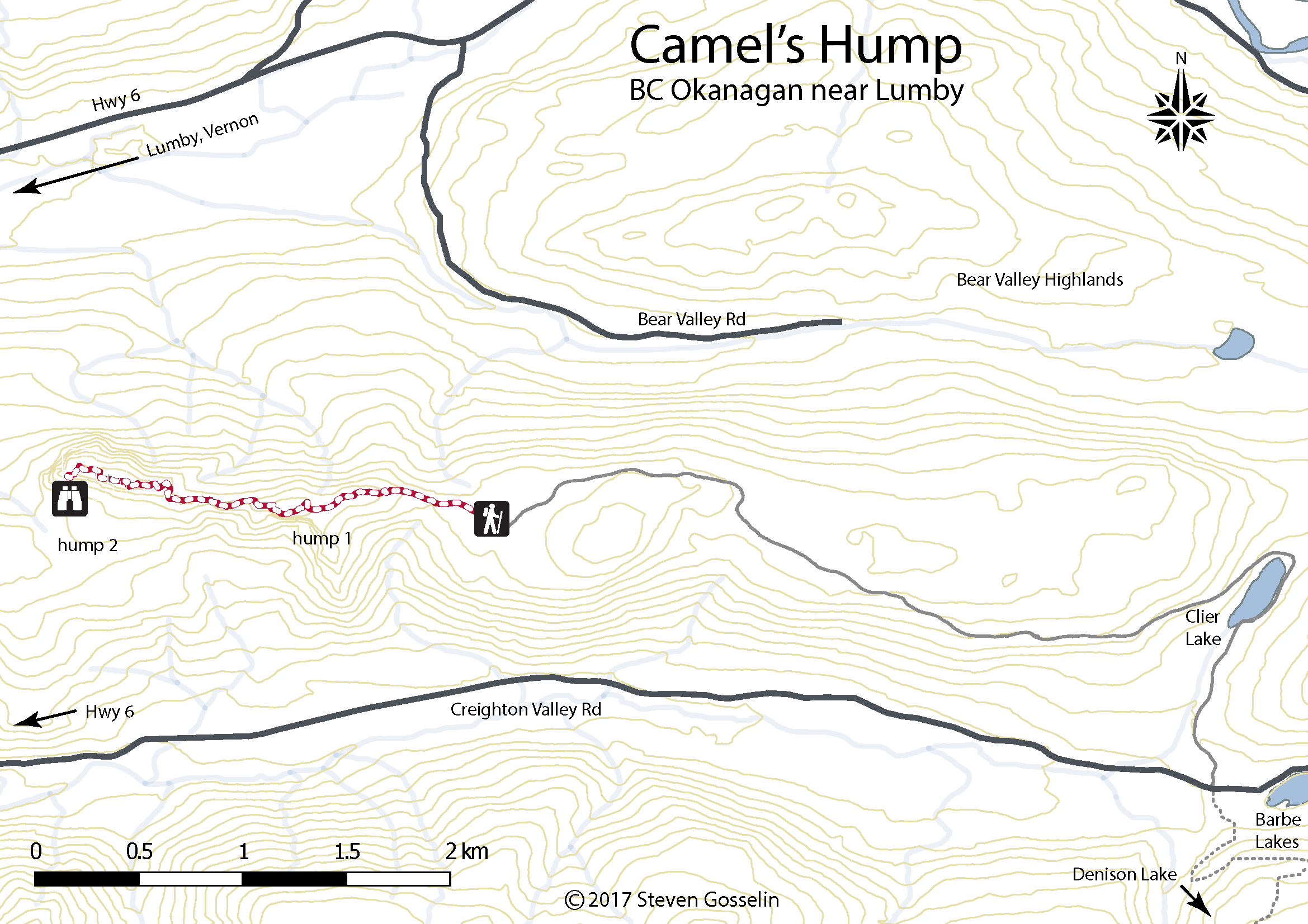
Head east from Vernon on Hwy 6 through Lavington and Lumby. Immediately after passing through Lumby, turn right on Creighton Valley Rd. Continue as the paved road turns to (well maintained) gravel. The next turn is not easy to spot but it is 16km from the Hwy 6 turnoff and officially called Clier Lake service road. If you see a lake on the right, you just missed the turn. If you get to Echo Lake Provincial Park, you went a kilometer or so past.
Anyway, at that 16km mark, turn left (there is also a road heading right). The road heads north around Clier Lake then loops back west toward the trailhead. Keep left just after the Clier lake to avoid an unwanted offshoot. Not long after, the road gets too difficult for small cars, however, a 4×4 with high clearance can make it all the way to the trailhead. Last time we made it 2km or so from the trailhead with our small car – just park on the road and walk the rest of the way to the trailhead.
Distance from downtown Kelowna to Trailhead:
Walking time: 1-3 hours
Trail Length: 2km round trip
Elevation gain: 80m
GPS: Not necessary
Easy to Keep on Trail: some places


Hello Steve
What a fantastic blog, thank you sharing all the info, really well done.
We have just incorporated a new not for profit trail society in Lumby. We are the Monashee Trail Society. I am hoping to get permission use your image of Camels Hump to make our Logo.
I didn’t see any great photos but, absolutely! Go for it.
Hi would you be able to label some of the other monashees in that pic? I can’t figure them out.
Hi Jim,
The peaks in that picture behind camel’s hump are all part of the Mark Berger Traverse. At the far left (north) there is the hike to Twin Lakes. Hiking from there towards Severide you first get to the peak above Twin Lakes called Lakeview. Continuing south along the ridge you get to Boulder Mt first then Neopolitan (Layer) Mt. and finally Severide. Between Severide and Pinnacle I believe that is called Sun Peak. In the foreground of this ridge (behind camel’s hump) is Mt. Beaven.