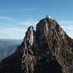
East Peak is really just a bump beside a bunch of other bumps. It is only really special from an alpine touring / backcountry skiing perspective. It is possible to hike across the ridge in summer from Big White summit but little reason to do so. There are few places in the Okanagan for good ski touring. Most peaks aren't tall enough to sustain good winter conditions and those that are don't have great access options. East Peak (officially Big White slack-country) has therefore become an objective both for its ease of access and height (2251m).
Skinning up the east side of Smoker's Bowl. Summit in background.
Access
East Peak is currently out of resort bounds, although there are future plans to one day include it in a Big White expansion. It is possible to hike over from the top of Cliff Chair but there is also a method to completely avoid the resort (and lift tickets). Park at the Black Forest parking lot and head into the backcountry by way of the snowshoeing trails. It is then possible to skin up through the forest and eventually arrive at the (south) base of East Peak.
Touring up through the forest from Black Forest parking lot
Ski Options
The south face of East Peak (locally known as Smoker's Bowl) is the obvious route to the summit and also makes for a fantastic route down. There are a number of satisfying lines off the backside (north being the more mellow and east much steeper).
East Peak has avalanche terrain and users must have the proper training and planning before attempting winter access. The area is also next to the popular Greystokes snowmobile lands and there could be those type of visitors accessing from the east.
Sugar is an uninteresting mountain compared to neighboring summits in the Monashees. However, it is unique for having an in-tact abandoned fire lookout station.
There is a trail up the mountain but it is better classified as an ATV trail. It is moderately popular with the offroad community and therefore it is usually clear of treefall. Since it is technically possible to drive up with an ATV, it is not as popular with hikers.
Sugar Mountain on the way up
Since a summer hike would be pretty boring compared to surrounding trails the option of a winter ascent can be an option. There is only one issue with this - access. Kate Creek FSR is generally not plowed in the winter unless there is logging in the area. However, there are a couple windows per year where road access at is possible and there is still snow on the trail (late fall, early summer).
Typical trail half way up
We chose to attempt the trail as an alpine tour and managed to time the approach perfectly. In mid-November, there ample snow for a good ski but not enough at lower elevations to block trailhead access.
In Cherryville, BC, turn north at Frank's General Store onto Sugar Lake Road. This road is in good condition all year round and accessible via 2WD vehicle. Just before reaching Sugar Lake, turn right on Kate Creek forestry service road. There are limited signs past this point so a good map/GPS is required. 2.6km later, turn left to stay on Kate Creek FSR (not straight onto Kate Creek Sitkum FSR). Park at 17.6km from Sugar Lake road at the obviously logged road that stretches up the mountain. As of 2022 the road to the trailhead is very good and 2WD vehicle accessible. From the trailhead, it is roughly 10km to the top.
Sugar Mountain itself is not noteworthy but the views from the top of the surrounding Monashee Mountains are fantastic. The pinnacles and Mount Severide are clearly visible to the south as are the peaks of Goat, Initiative, Fosthall, Odin, Thor, Niflheim, and Kelly to the west.
Monashees as seen from the west (Goat at far right, Fosthall left of centre)
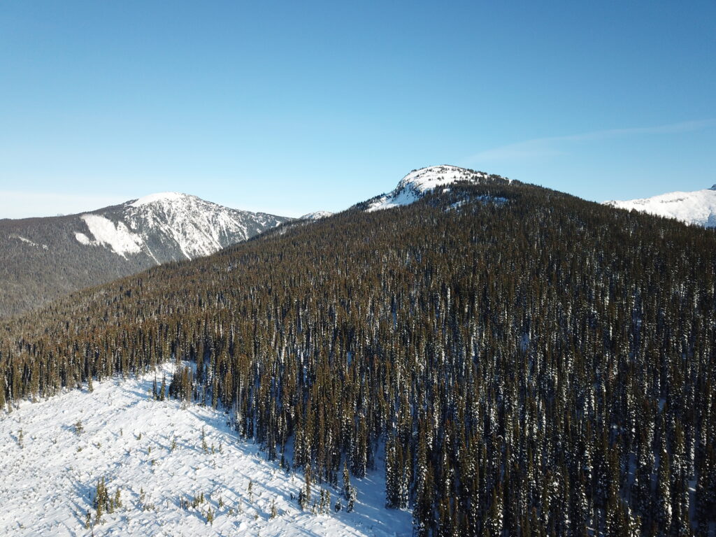
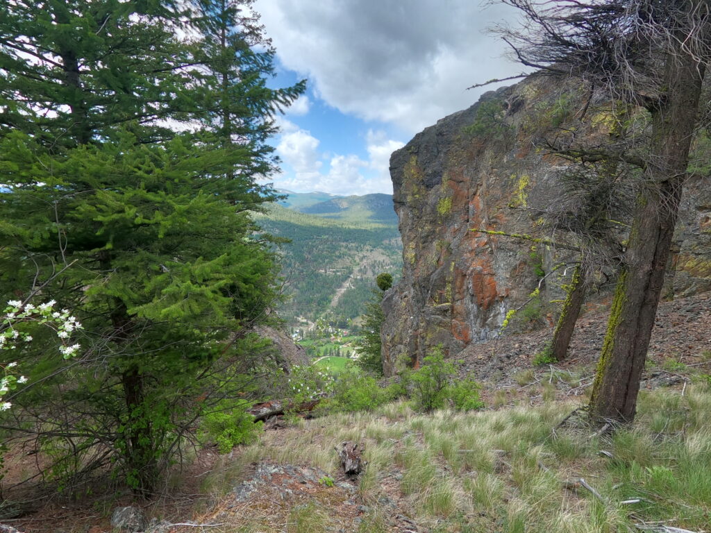
Many BC hikes start off with mundane climbs through sub-alpine forest and the route up to Brent Mountain is no exception. What sets this hike apart is the incredible summit experience, with 360 views and an awesome abandoned fire lookout tower. On a clear day there are excellent views of the Cathedral peaks and other surrounding peaks deep into Washington to the south and as far as the Monashees to the north.
Brent Mountain Fire Lookout
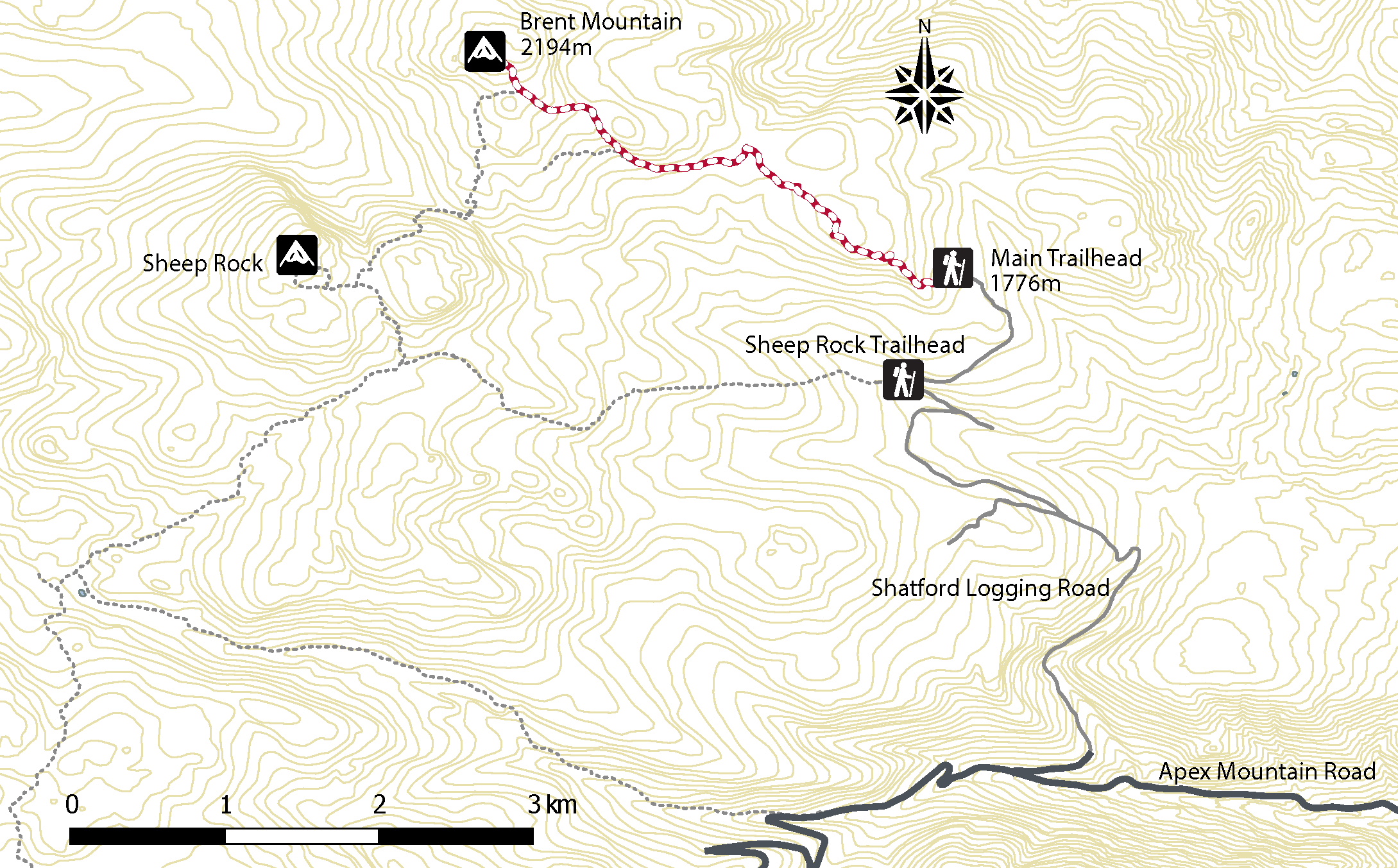
Directions To Trailhead:
From Green Mountain Road, turn onto Apex Mountain road and after 4km turn right (north) onto an old (Shatford) logging road. From there it is 7.5km and there are some signs indicating the direction. There is a network of logging roads criss-crossing the area so don't go more than 5km if there is no sign. There is the Sheep Rock Trailhead which accesses Mt. Brent via Sheep Rock Mountain.
Take extra precaution if looping up to Brent via Sheep Rock. A GPS is highly recommended as the trail is easy to lose. A couple km up the road past the Sheep Rock trailhead is the official main trailhead. From this starting point, the hike is quite straight forward, with a gentle incline for most of the journey.
click on map for higher res version
https://youtu.be/zO37yt31ITI
Sheep Rock with Brent Mt. in the background
Penticton to Trailhead: 32km Hike Return time: 3-4 hours (from main trailhead) Trail length: 5km one way (from main trailhead to summit) Elevation gain: 490m GPS: not unless venturing on side trails or to Sheep Rock Clear trail: yes (from main trailhead)
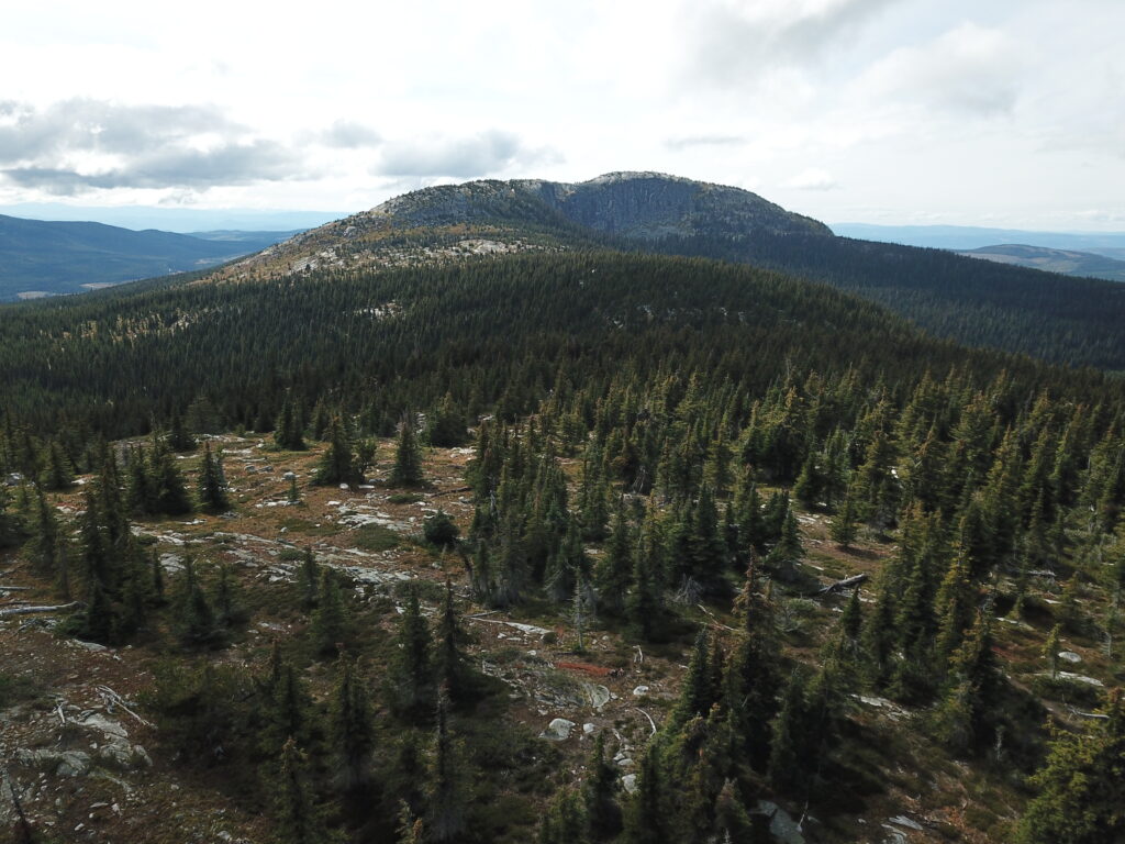
Little White - the remote and undeveloped younger sibling of that other mountain. This is one of the taller mountains in the Okanagan cracking the 2000m mark. The summit area is a huge exposed slab of rock which makes for incredible 360 views. Access to any of the trailheads requires some degree of off-roading so this is not your casual family day-hike. This also implies that some planning is required and also choosing the appropriate season (July-October).
View north Little White summit
There are at least 5 different access routes for Little White - Hwy 33 / Okanagan Falls Rd / Greyback Rd / Canyon Lakes Rd, Little White forestry service road, Upper Crawford Trail, Highland trail from Chute Lake, and Highland trail from Hydraulic lake or Hwy 33.
Directions To Trailhead (Canyon Lakes):
The shortest hike up Little White is via Canyon Lakes trailhead. Unfortunately, the drive to the trailhead is much longer than others. The last 5km is doable (barely) in an SUV but a high clearance 4x4 is recommended. Take HWY 33 out of Kelowna and turn right about 20 mins later on Okanagan Falls FSR (towards hydraulic lake). Follow the signs to Idabel lake but continue past the final turnoff (to Idabel lake). 22.1 km from HWY 33 turn right at the T intersection then stay right at the Y 2.6km later. The trailhead is obvious 6.5km later (the last 5 being the really rough rocky snowmobile trail).
Hiking up from Canyon Lakes
https://youtu.be/DClfbHgKjHM
Approaching the summit from Canyon Lakes Trailhead
Directions To Trailhead (Upper Crawford):
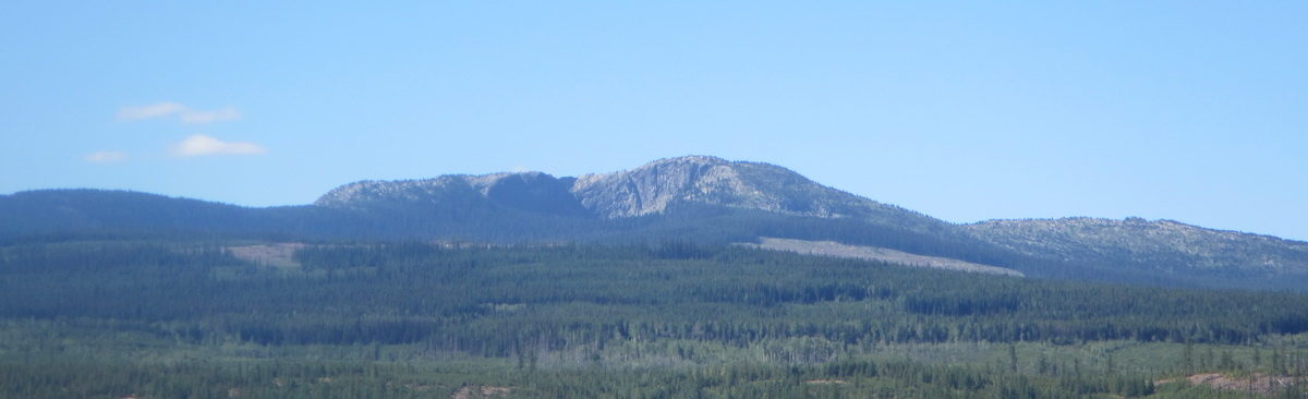
The most straight forward (but harder) trailhead from Kelowna is the Upper Crawford. From McCulloch Rd in south Kelowna turn onto the unpaved June Springs Forestry Service Rd and follow it all the way until it meets with the KVR (kettle valley railway) trail.
It gets a bit sketchy here but it is 100% possible with a regular car. Turn right onto the KVR - watch for cyclists ;) Drive approximately 7km along the trail until you reach the Bellevue Trestle (as far as is possible to drive). Along this route you have to navigate through some tight spaces with rock walls on either side and some precarious narrow sections with no barriers on the cliff edge. As you approach Bellevue Trestle on the right, go straight and curve left up to where there is parking and the trailhead for the Upper Crawford Trail.
KVR from Ruth Station towards Bellevue Trestle (ie. drive this way)
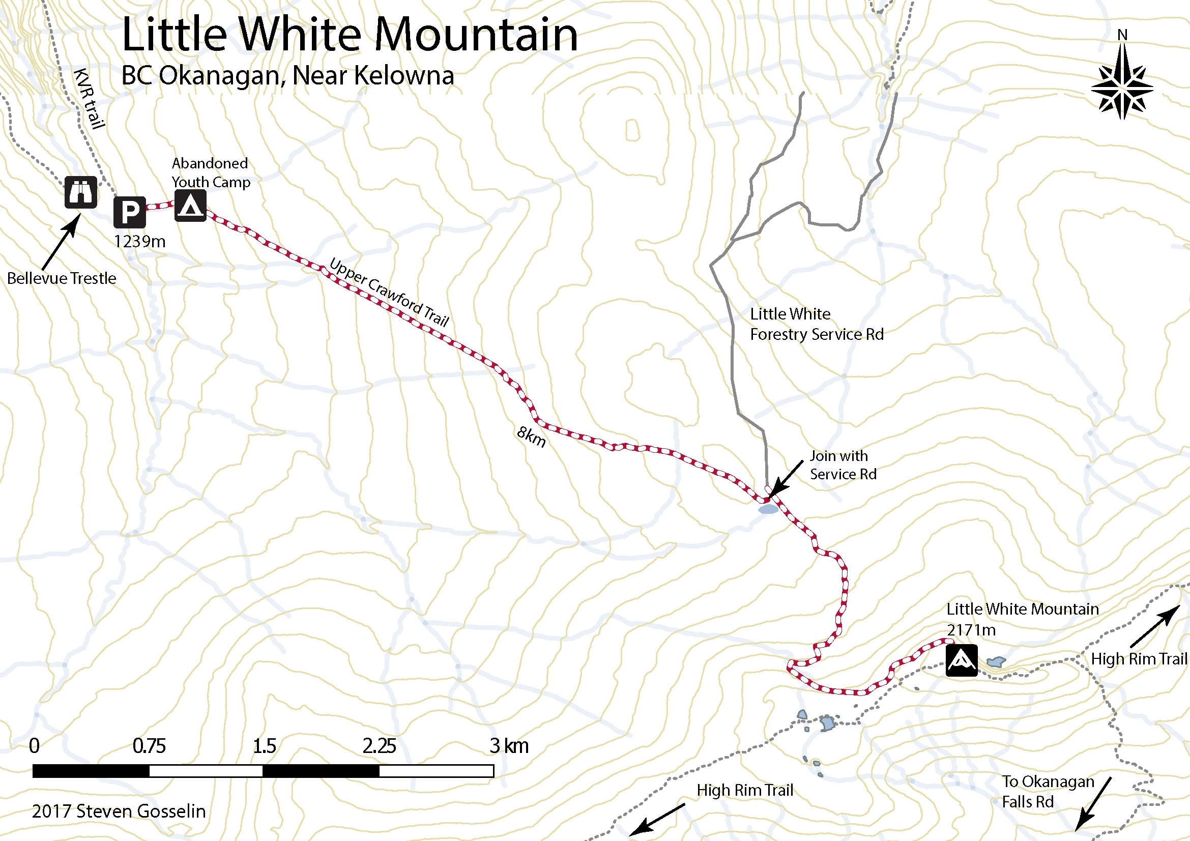
The trail climbs steeply at first and after about 1km there is an abandoned Youth Corps camp. From here the trail is more gradual (mountain bikers use it) and at 5.5 km from the trailhead the path joins with the Little White Forestry Service Rd. Follow this or as the summit is clearly visible from here, make a beeline through the sparse vegetation.
Click on map for a higher res version (Upper Crawford Trail)All that remains of the fire lookout on Little White
Distance from Kelowna to Canyon Lakes Trailhead Walking time: 4-5 hours round trip Trail Length: 12km round trip Elevation gain: 450m GPS: Not necessary but always a good idea for these remote hikes. Easy to Keep on Trail: Yes, trail is well worn.
Distance from Kelowna to Upper Crawford Trailhead: 45 minutes Walking time: 6-8 hours round trip Trail Length: 16km round trip Elevation gain: 930m GPS: Not necessary but always a good idea for these remote hikes. Easy to Keep on Trail: Yes, trail is well worn.
You'll notice on the map above there is an icon for Abandoned Youth Camp. The camp was abandoned in the 1990s and is worth further inspection. It can be found near the start of the Upper Crawford Trail up to Little White Mountain just off the KVR trail. One weekend we actually camped in the abandoned camp and tried to find all the items on the old map which stands at the entrance.
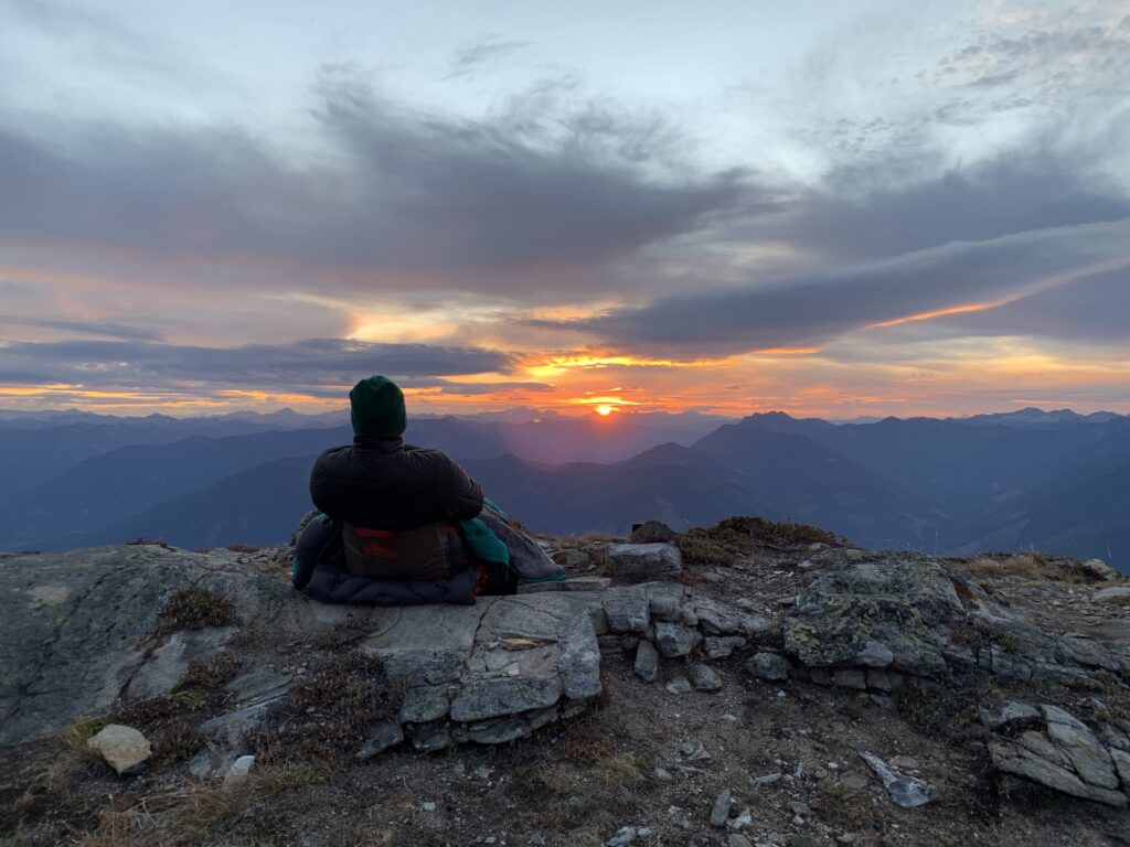
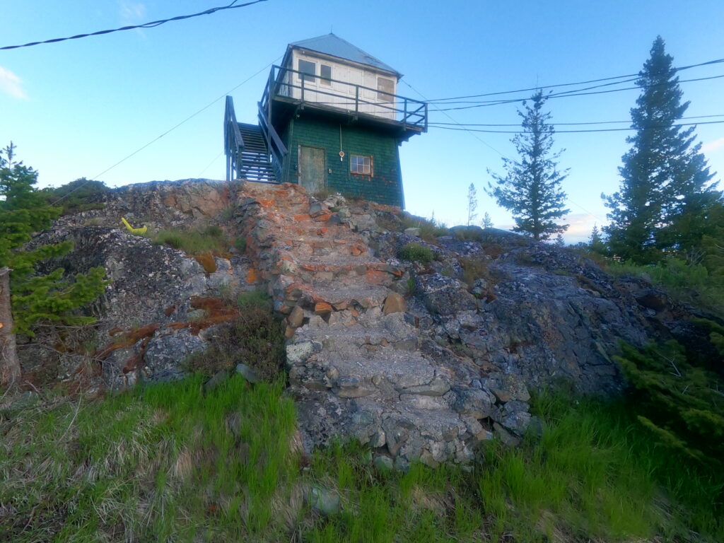
Saddle Mountain is a classic hike out of Nakusp with unparalleled views and an epic location for a restored fire lookout tower. With a decent gravel road most of the way up, the hike to the summit is only a few hours.
Overnight at the summit
The ultimate adventure is to hike to the summit and overnight in the lookout. This has become very popular since recent renovations have made the lookout a little too comfortable. There is no reservation process so first come first serve. Best not to even try for a Saturday night in the summer.
The hike is accessed via Arrow Park Ferry so make sure to confirm crossing times before hiking.
Sunset on Saddle
https://youtu.be/3WkAfZPUfO4
From the lookout, it's possible to drop down over the north side and traverse over to the actual summit (Upper Saddle Mountain). Some route-finding is necessary and there is no trail but if navigated correctly, it is not technical.
It's always interesting to paddle a chain of lakes and one such chain exists above Lake Country BC. It is possible to paddle from Dee Lake to Island Lake to Deer Lake to Crooked Lake to Beaver (Swalwell) Lake in a day of paddling but there are so many options for rugged lakeside camping that it's worth making it a 2 day trip.
We chose to start at Dee Lake Rec site which involves carrying gear 300m from parking to lakeside. From here it is a straightforward paddle until the dam between Crooked and Beaver lakes. It is a short and manageable portage. We camped on an island in Deer lake but there are dozens of potential camping spots (see map below). While it is possible to park vehicles at both ends, we decided to stash bikes at one side and it ended up only taking 40 mins to bike around the lakes along the forestry road.
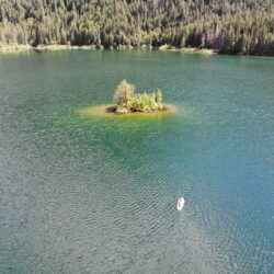
Spectrum Lake Island (yes we hiked in a paddle board)
Spectrum Lake was that location that we used to walk by on the way up into the Monashees. In recent years with young children, it has become a great little weekend destination for beginner backcountry experiences. This has been the revelation by many many others and now hot Saturday nights are filled to capacity and then some. Nevertheless it is a picturesque spot worth the effort for a couple nights of camping.
Spectrum Lake is the only backcountry lake that I can think of in the region that has a dock. At face value this doesn't seem like a significant feature but it has become sort of the campground hang out and mingling hub. Most backcountry lakes are frigid and it is difficult to get aquainted with more than the first few meters of the shore. The Spectrum dock gets you away from the trees and out into the lake to take in the majesty of the surroundings. Wow a whole paragraph about a dock.
Aside from the noted dock, there is also an outhouse and bear cache.
https://youtu.be/8bqq7xAo4Ak
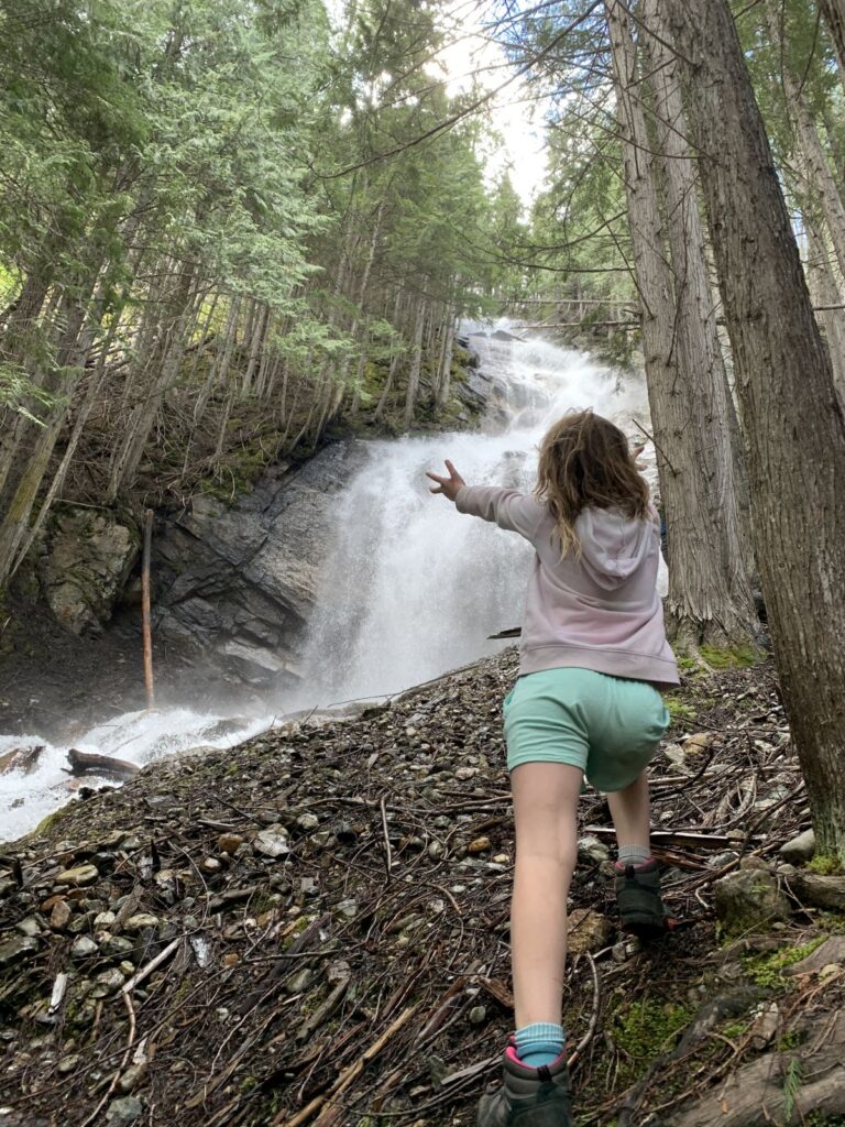
In recent years, the path to the waterfall near the lake has become more well known and more accessible. Find it by walking past the bear cache and crossing the log across the river at first opportunity. Navigate the log gauntlet for a bit and be shocked at how the waterfall was bigger and better than expected!
This may have been anecdotal but in the worst year for bugs in living memory (summer 2022), Spectrum Lake had very few. Maybe it is a special spot!
The abandoned fire lookout on Mt Hamilton (Quilchena, BC) seldom sees visitors since the surrounding landowners have stopped public access up the service road. There is crown land on several sides of Mt. Hamilton which makes for the only legal access at the moment. I chose to hike in (see map below) from the west side off Pennask Lake Rd which ended up working but it is by no means an easy or straightforward route.
There are two obvious access points to Rattlesnake Mountain that should NOT be used. The first is the network of trails seen on the Alltrails app starting off Garnet Valley Road. This is private land and the landowner will ask you to leave. The second is seen on various Summerland city literature with trailhead at the end of Cristante Road. There is a locked impassible gate at the end of Cristante Road with no access.
Some have been parking along Sandborn Road where the new Hunting Hills subdivision is under construction. Many report having no issues starting here but officially it is not allowed because of ongoing construction. Use at your own risk.
It is apparently possible now to contact Wild Horse Ranch and with their permission, park below their driveway and hike through their property. This looks like the most viable option as of summer 2022.
A potential access point (not verified yet) would be to try accessing off Garnet Valley Road 1.2km north of Jones Flat Rd. Parcel 18654 is municipal land (search here) designated as park so theoretically should avoid any private land (but nearby parking is an issue).
See the google map below for more details on all access related issues.
Hiking the cliffs along the west side of the summit
https://youtu.be/Vk8fZ2r_h8g
Important Trail Information
There is no trail up Rattlesnake Mountain. Route-finding is necessary although this is not so hard as there is very little undergrowth. At times the Goat Trail (mountain bike trail) heads in a useful direction for hikers and at other times animal trails are available. There are no obvious trails close to the 'summit.'
There are viewpoints at the top of Rattlesnake Mountain over the beautiful Garnet Valley as well as in every other direction across the Okanagan. The rugged cliffs at the west side of the mountain are of particular interest.
The hike (using route highlighted on the google map) is approximately 9km round trip and takes around 3 hours.
Cliffs along the west sideView to the south - Giants Head a notable landmark
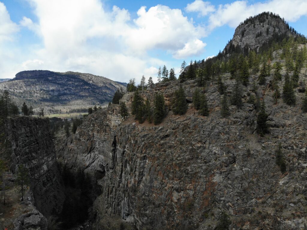
*note that while government websites suggest the Vaseux Protected Area has hiking options, it is surrounded by private property and Osoyoos Indian Band Lands making access difficult*
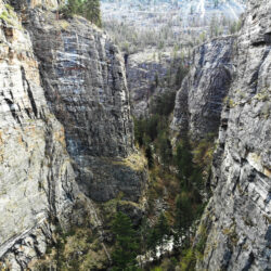
The Vaseux Protected Area has a number of features that would have interest for the exploring hiker. Gallagher's Bluff stands out as one of the prominent bluffs in the area (along with McIntyre Bluff and Eagle Bluff). There is also the Vaseux Creek Canyon with its stunning vertical walls. The protected area is of course a great spot to view California Bighorn Sheep.
A government document states that access to the Vaseux Protected Area "Site 1 is accessed from a gravel road and site 2 from the Okanagan Falls Service Road." This does not provide enough detail and there is no indication on related maps of where these access points lie.
Two other optional access points: 1) Hike up from Gallagher Lake 2) On the Eagle Bluffs hike, skirt around Eagle Bluff on the east side and continue on into Vaseux Protected Area
View from Gallagher Bluff (with McIntyre Bluff in the background)