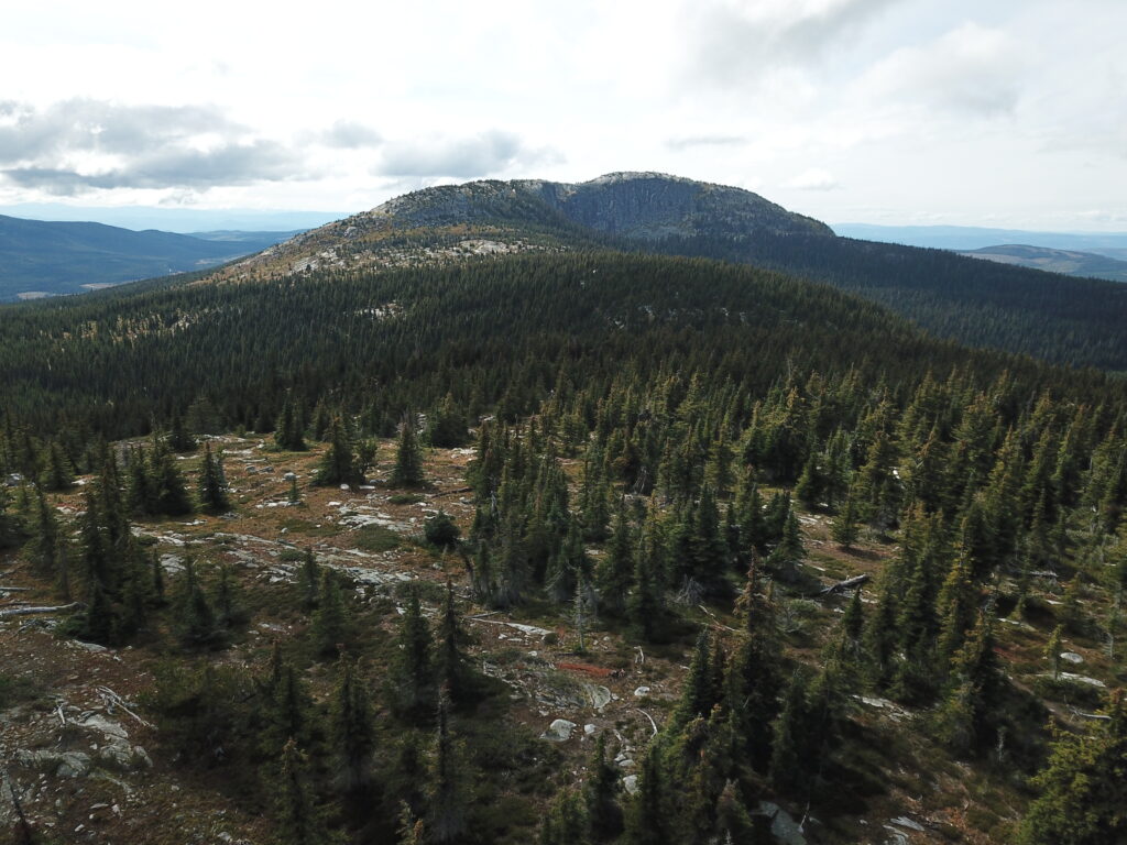
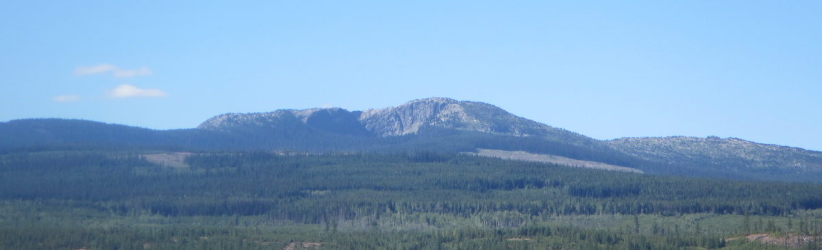
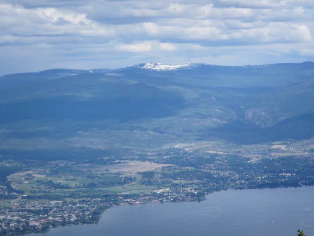
Little White – the remote and undeveloped younger sibling of that other mountain. This is one of the taller mountains in the Okanagan cracking the 2000m mark. The summit area is a huge exposed slab of rock which makes for incredible 360 views. Access to any of the trailheads requires some degree of off-roading so this is not your casual family day-hike. This also implies that some planning is required and also choosing the appropriate season (July-October).

There are at least 5 different access routes for Little White – Hwy 33 / Okanagan Falls Rd / Greyback Rd / Canyon Lakes Rd, Little White forestry service road, Upper Crawford Trail, Highland trail from Chute Lake, and Highland trail from Hydraulic lake or Hwy 33.
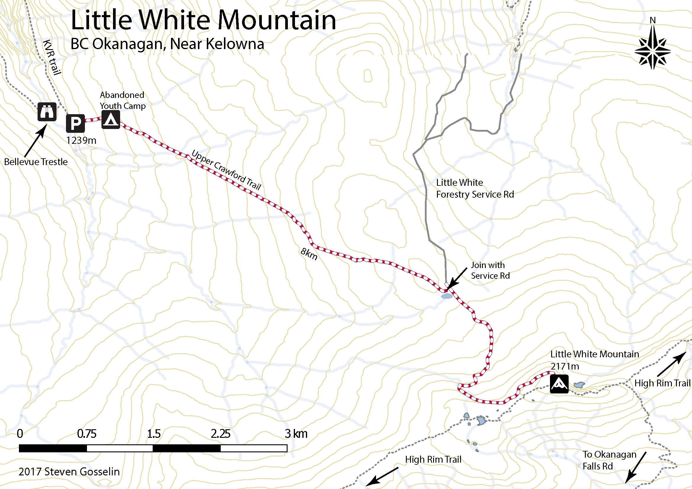
Directions To Trailhead (Canyon Lakes):
The shortest hike up Little White is via Canyon Lakes trailhead. Unfortunately, the drive to the trailhead is much longer than others. The last 5km is doable (barely) in an SUV but a high clearance 4×4 is recommended. Take HWY 33 out of Kelowna and turn right about 20 mins later on Okanagan Falls FSR (towards hydraulic lake). Follow the signs to Idabel lake but continue past the final turnoff (to Idabel lake). 22.1 km from HWY 33 turn right at the T intersection then stay right at the Y 2.6km later. The trailhead is obvious 6.5km later (the last 5 being the really rough rocky snowmobile trail).
Directions To Trailhead (Upper Crawford):
The most straight forward (but harder) trailhead from Kelowna is the Upper Crawford. From McCulloch Rd in south Kelowna turn onto the unpaved June Springs Forestry Service Rd and follow it all the way until it meets with the KVR (kettle valley railway) trail.
It gets a bit sketchy here but it is 100% possible with a regular car. Turn right onto the KVR – watch for cyclists 😉 Drive approximately 7km along the trail until you reach the Bellevue Trestle (as far as is possible to drive). Along this route you have to navigate through some tight spaces with rock walls on either side and some precarious narrow sections with no barriers on the cliff edge. As you approach Bellevue Trestle on the right, go straight and curve left up to where there is parking and the trailhead for the Upper Crawford Trail.

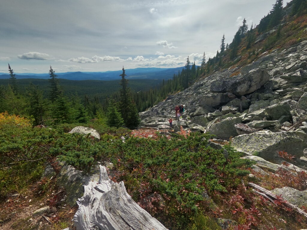
The trail climbs steeply at first and after about 1km there is an abandoned Youth Corps camp. From here the trail is more gradual (mountain bikers use it) and at 5.5 km from the trailhead the path joins with the Little White Forestry Service Rd. Follow this or as the summit is clearly visible from here, make a beeline through the sparse vegetation.

Distance from Kelowna to Canyon Lakes Trailhead
Walking time: 4-5 hours round trip
Trail Length: 12km round trip
Elevation gain: 450m
GPS: Not necessary but always a good idea for these remote hikes.
Easy to Keep on Trail: Yes, trail is well worn.
Distance from Kelowna to Upper Crawford Trailhead: 45 minutes
Walking time: 6-8 hours round trip
Trail Length: 16km round trip
Elevation gain: 930m
GPS: Not necessary but always a good idea for these remote hikes.
Easy to Keep on Trail: Yes, trail is well worn.
Technically this mountain does fall into our series hiking mountains with loud eyesore communications towers on top but we do it anyway but it is rather tactful so as to not take away from the hiking experience.
Side Quest:
You’ll notice on the map above there is an icon for Abandoned Youth Camp. The camp was abandoned in the 1990s and is worth further inspection. It can be found near the start of the Upper Crawford Trail up to Little White Mountain just off the KVR trail. One weekend we actually camped in the abandoned camp and tried to find all the items on the old map which stands at the entrance.
Just did this hike Aug 2018. The access road KVR you pretty much need a Jeep. The ruts are to deep for most cars and the washout combined with large rocks meant my truck could not navigate it. If you bring a bike how ever it’s super easy to ride and all flat hard pack. I saw touring bikes riding it.
The trail is maintained but also over grown and when rainy well a good part of the path is a creek so I suggest going when it’s dry. It’s awesome mix of tress, bush, marshy, and more trees. It’s a climb the entire way up with very few flat or down hill.
The hiking map shown I don’t think is 100% accurate near the end. You have to go past the junction to the summit of little white. An extra 1.5kms but you can see the towers sticking up anyways from the junction.
I recorded 29.5kms with 1400m elevation change. The stopping before the end of the KVR added 6kms each way to my total distance.
Best hike so far in the area. GPS, lots of water, and bear spray are good to have.
Just a tidbit, what is labeled as High Rim Trail is actually the Highland trail. There are two different trails that, yes, join together as one but both begin at Mission Creek. Mission creek separates the two. Highland ends at Chute Lake and High Rim ends in Vernon.
Totally! I can’t believe I didn’t notice this before. Everyone always talks about the HRT as Cosens Bay to HWY 33 but of course it actually goes to Mission Creek and that is the switchover point to Highland Trail. I feel so enlightened! On a related note I don’t hear people doing the Highland trail. It’s on my list for asap and now I even know what to call it!
I’m doing Highland back to back with High Rim this year. There is a section though that is referred to as “blowdown hell” which makes it tough to pass but I am hearing if people making it through.
Actually, that section scares me lol. I had to turn back from Big Meadow Lake last time due to my feet having some issues. The start of that section (after the open climb that passes that fsr) looked really sketchy. Dark and scary like the Upper Crawford (lol yes I found Upper Crawford to be scary like…just so dark and dense eeeeeek).
Anyway hoping for some success this year.