
KLO Creek follows what must be the stream of the same name from the outskirts of Kelowna up to the KVR trestles above Myra Canyon. The trail cuts back and forth across the stream across a variety of bridges with various degrees of engineering. After the winter, the creek swells destroying many of the makeshift bridges. The trail is popular enough that chainsaw hikers have the path navigable by late spring.
Near the beginning of the trail there is a curious pipe crossing the river and heading up the riverbank in both directions. This can be followed either way to investigate the old flume-aqueduct networks. At several points along the trail there are sections of steep rock popular with the climbing community. Near the halfway point of the trail there is the option to loop back via Angel Springs trail (see below).
[caption id="attachment_3325" align="alignnone" width="834"] One of the more professional bridges at the beginning of the trail[/caption]
Directions To Trailhead:
The trailhead for KLO Creek is at the sharp turn on McCulloch Rd in the canyon not far past Gallagher’s Canyon Golf & Country Club (just past both turns to the KVR trestles).
[caption id="attachment_3248" align="alignnone" width="450"]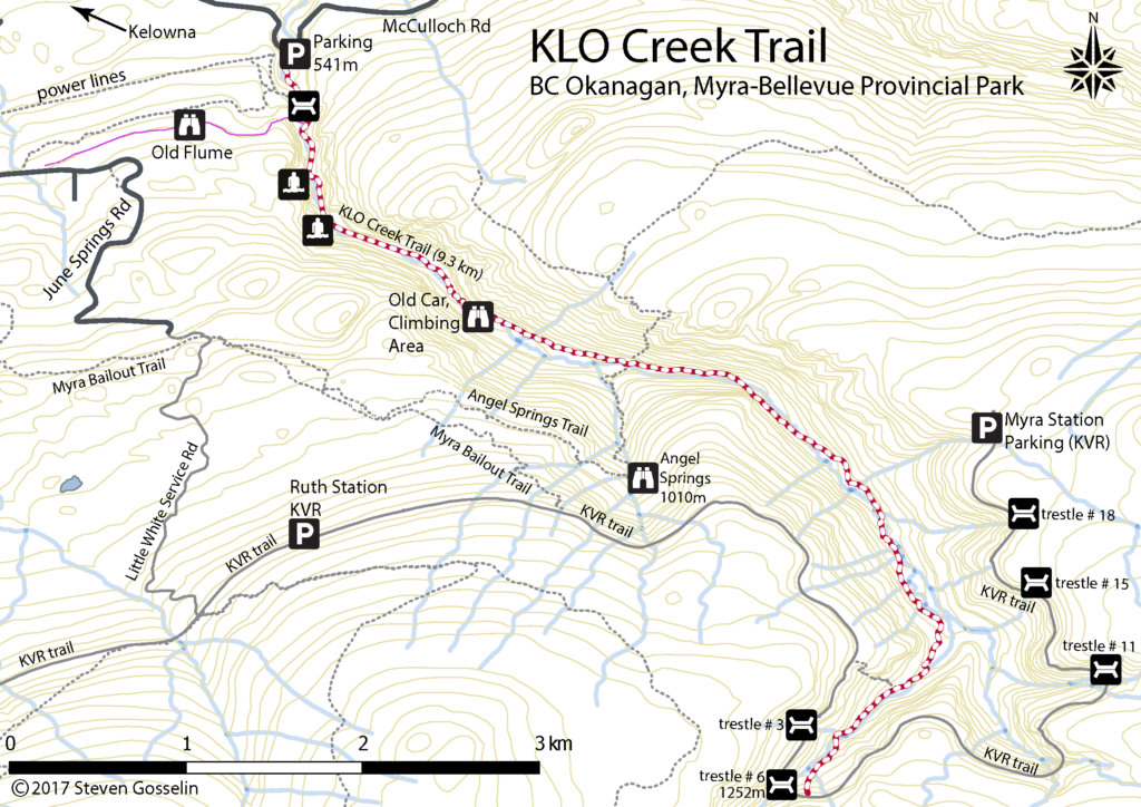 Click on map for a high-resolution version[/caption]
KLO Creek Loop + Angel Springs
Start at the KLO Creek trailhead and follow the creek into the forest as it meanders up into the hills. Follow the trail for 4km and there will be signs indicating a river-crossing towards Angel Springs. Here the terrain inclines quite a bit before finally meeting with the end of the Angel Springs trail. Follow Angel Springs trail to the beginning at June Springs Rd. From here to get back to the KLO Creek trailhead there are few options. If you walk down June Springs Rd 3km there are some paths that cut over to the KLO Creek trail. If you can’t find these then walk a bit further to where there are large transmission lines crossing the road. Turn right and follow the path under the transmission lines which eventually joins KLO Creek trail not far from the trailhead.
[caption id="attachment_3323" align="alignnone" width="834"] We all want to know how this car got here[/caption]
Distance from downtown Kelowna to Trailhead: 25 minutes
Walking time: 4-6 hours round trip, 4-6 hours when combined Angel Springs trail for a loop
Trail Length: 9.3km (one way), 17km when combined with Angel Springs for a loop
Elevation gain: 520m
GPS: Quite useful as trail is poor in places
Easy to Keep on Trail: Clear in some places but generally not maintained and shifting with seasonal runoff
[caption id="attachment_3321" align="alignnone" width="834"]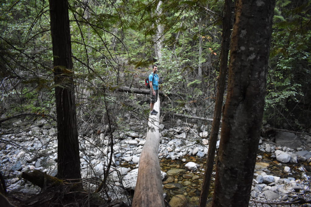 One of the KLO creek crossings[/caption]
[caption id="attachment_3324" align="alignnone" width="400"] One of the climbing areas along the trail[/caption]
