A couple adventures while visiting New Brunswick in the Canadian Maritimes

steveamie.com
steveamie.com
A couple adventures while visiting New Brunswick in the Canadian Maritimes

A small adit to explore between Gladstone and Pincushion above Peachland, BC.
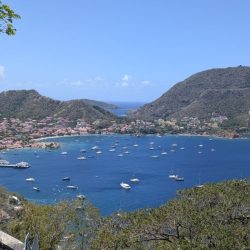
Guadeloupe is a French island in the Caribbean. We had a lot of fun exploring the island(s).

Pennask Mountain is an insignificant peak but it does have a decent view from the summit. I opted to visit this peak via ski touring in the middle of the winter to make the journey more interesting.
(adsbygoogle = window.adsbygoogle || []).push({});

From time to time there are work opportunities in Alaska and I've gotten in the habit of adding on a day or two to explore the surroundings outside Anchorage. The options are numerous and often a choice between amazing and incredible.

This year was my first opportunity to visit Alaska in the summer so I made sure to pack my camping gear and stay and extra night. I settled a hike up to Crow Pass which didn't disappoint.

(adsbygoogle = window.adsbygoogle || []).push({});
(adsbygoogle = window.adsbygoogle || []).push({});
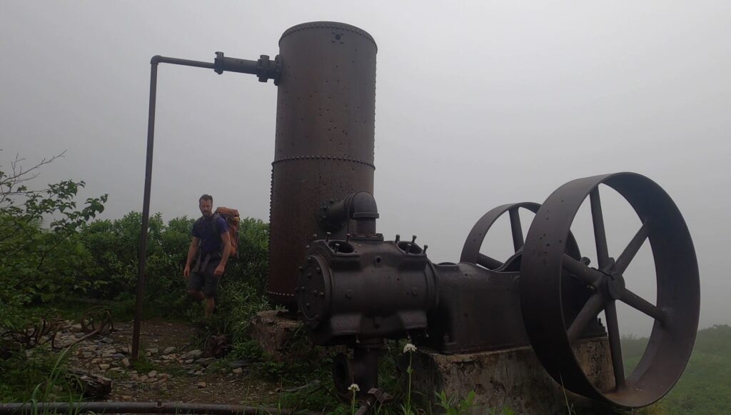
The hike up to the pass is quite interesting as you rise out of the valley, there are ruins of the abandoned Monarch Mine. There are many daytrippers up to the pass but very few choose to spend the night. A lucky few can secure the cabin that sits a picturesque spot near the glacier fed, Crystal Lake.

Without a cabin booking, it is still possible to back-country camp and there are a few bear caches set up near the hut.
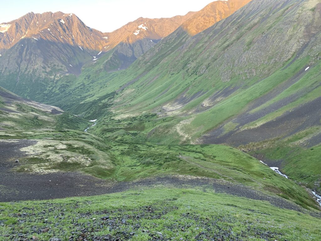
Camping at and exploring the pass is incredible but there time for more. I decided to head up Crow Peak which is not a straightforward endeavor. It ended up being quite a bit more arduous than getting up to the pass itself but rewarded spectacular views.


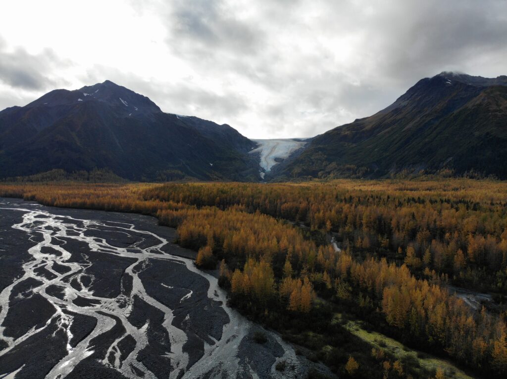
Another trip, I drove down to Seward and hiked up past Exit Glacier to the Harding Icefield. If glaciers weren't amazing enough, the source of the glaciers is absolutely outstanding and breathtaking.
The Harding Glacier route is within Kenai Fjords National Park and is quite a popular trail. The hike up to the icefield takes 3-4 hours and there are endless opportunities to explore from there.


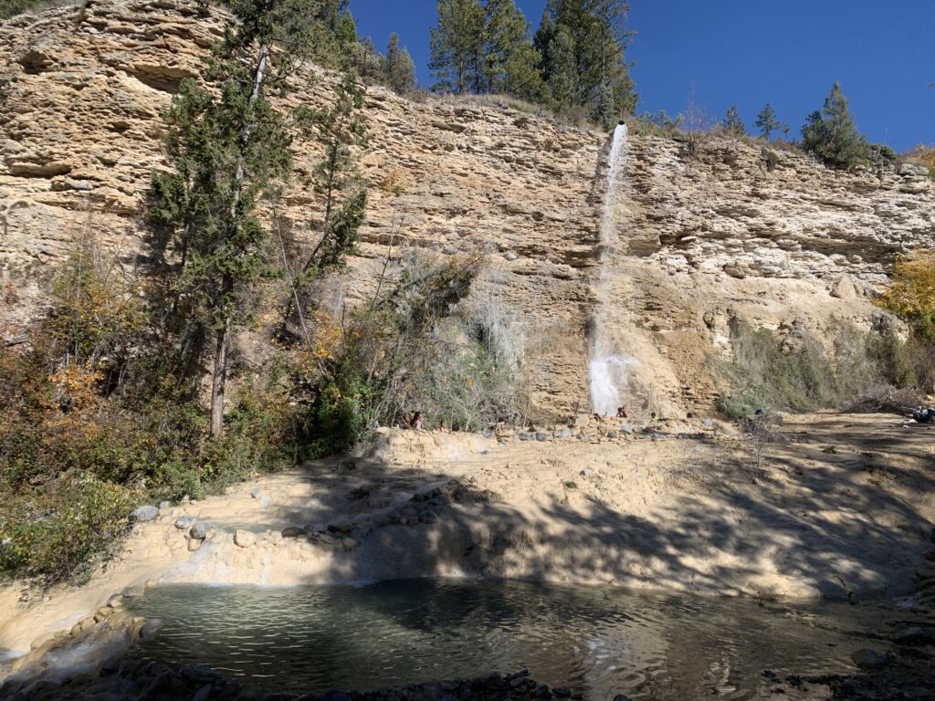
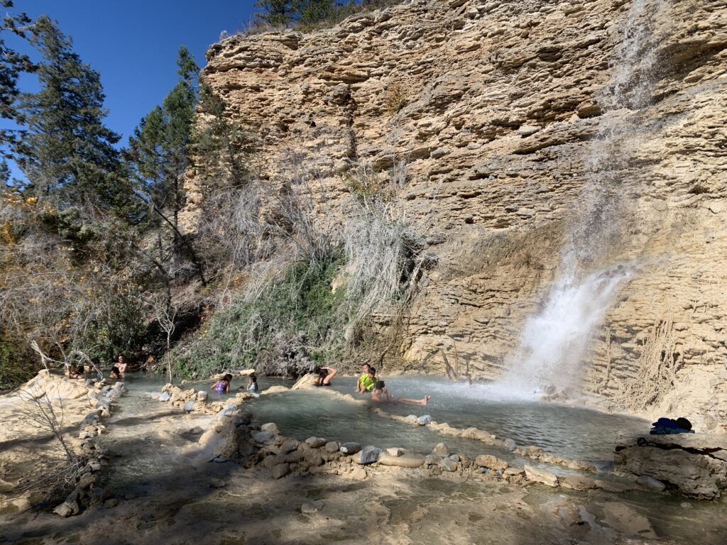
These hot springs look a lot like natural hot springs but they are really just run-off from the resort pools above. Having said that and at the right angle the whole area looks very picturesque.
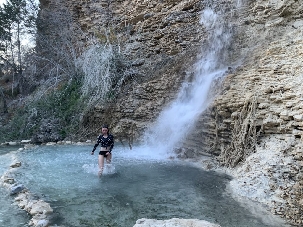
The water contains enough minerals that the river and pools are coated in calcium deposits. Seeing the naturally formed layers and entombed sticks and rocks makes the visit worthwhile even if dipping in the pools is not for everyone.
(adsbygoogle = window.adsbygoogle || []).push({});
Since the water temperature is dependent on the pools above, they are warm at best. On a cold day, there is some comfort sitting directly under the hoterfall but in general, most of the pools are not comfortable on a cold day.
Overall, this spot down the canyon from from Fairmont resort is definitely worth a visit even if the naturalness of the pools is in question.
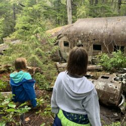
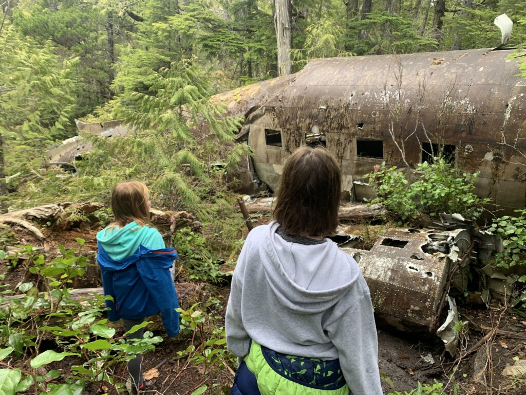
Hiking to a wreck is a great adventure and history lesson. We've explored several airplane and train wreck sites in the bush and each visit was an incredible and memorable experience.


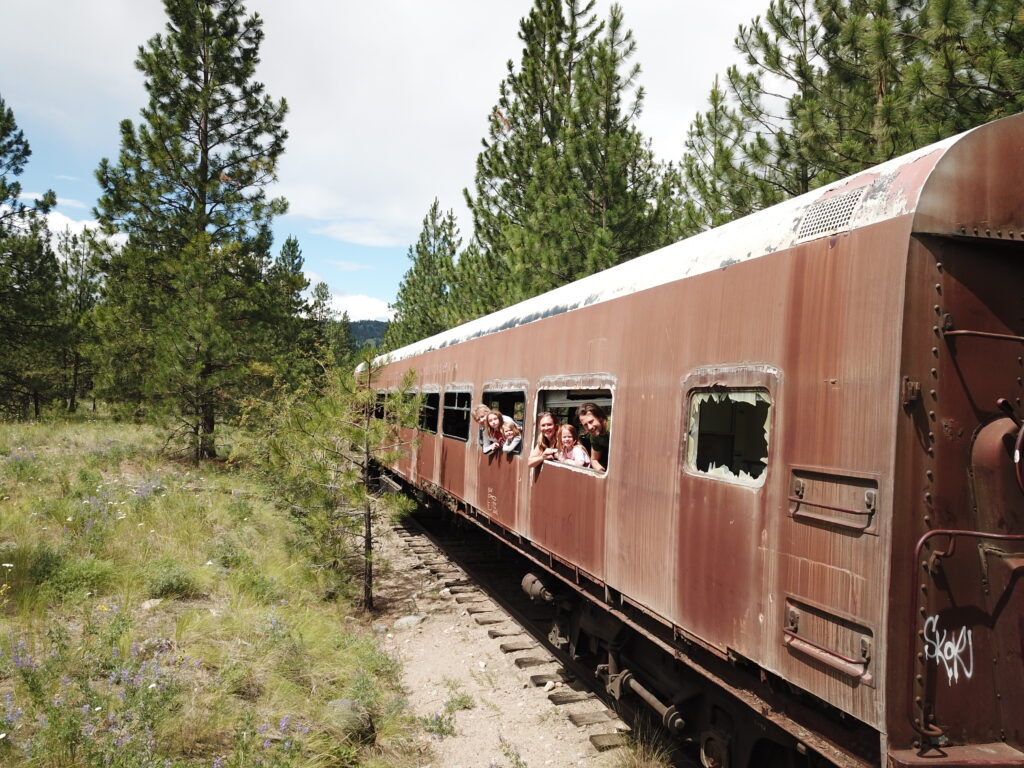
On Dec. 22, 1950 a flight from Vancouver to Penticton crashed on Okanagan Mountain. The pilot and co-pilot were killed because of the crash and the remaining 15 passengers and stewardess survived several chilly days in the wilderness awaiting rescue. There are many more details to the story and it is worth diving in further. For example, here.

A hike into the crash site is quite the adventure. It requires a substantial amount of bushwhacking and this endeavor continues to get more difficult every year as the underbrush and trees fill in (a fire in 2003 made the journey easier for a time).
Much of the wreckage was removed after the crash for salvage purposes but several large pieces still remain. The main site contains a wing and engine and has been explored by quite a few but rumour has it that the tail section remains undiscovered not terribly far from the main area.
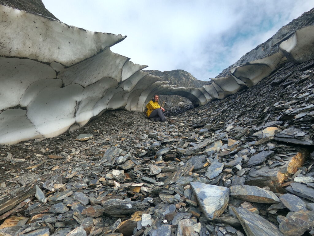
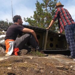
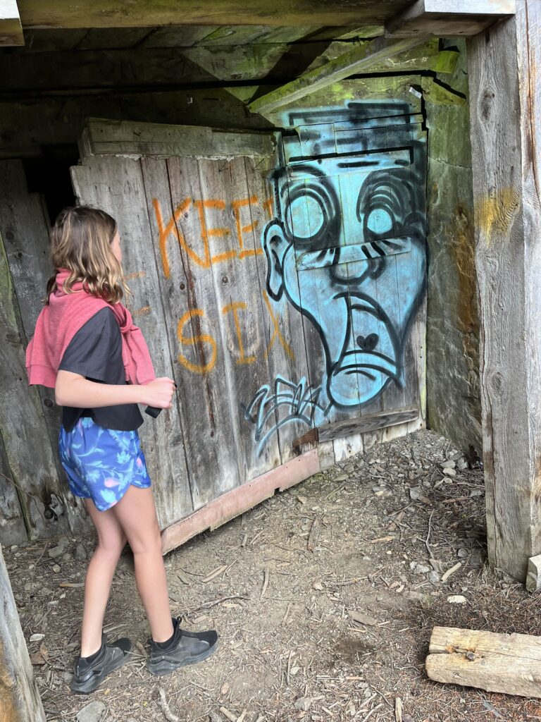
The abandoned French Mine near Hedley, BC is an intricate network of tunnels that apparently spans hundreds of kilometers. It is located in the same mountain-side as some other popular mines - Nickle Plate and Mascot. The mine entrances are well known and many explorers check them out on weekends.
There are many preserved relics around the mine entrances including a concentrator, ore shoot, and various staircases up the mountain. A gust of chilly wind greets you from the lower entrance (one indication that the air is quite good in the mine but this may not be the case deeper inside). The upper entrance is the most popular/photogenic as it features a large cavern with many holes.
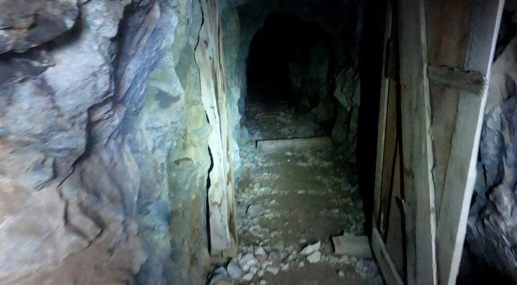
It is quite easy to get lost in the tunnels as there are many branches and levels. For the dedicated explorer it is possible to navigate (follow the red arrows!) from the upper entrance to the lower.

The tunnels are full of all kinds of discarded mining equipment like barrels, rail, ore shoots, and wires. There are old wooden ladders in various sections and open caverns in others.
Both the lower and upper entrances to French Mine are accessed via Hedley Nickle Plate Rd. Both are very rough and only passible by ATV or serious 4x4 offroaders. Most tend to walk in from either road.

It is also possible to 'hike' between the lower and upper portions. To this, follow the path up from beside the lower entrance (above/behind the concentrator) and follow the old wooden staircase. It is quite steep and soon you will reach the 'middle' entrance to the French Mines. Walk along the cliff-face to the left and the upper section will be around the corner. This should only be attempted by experienced scramblers as it is quite steep with some points of exposure along the cliff-face. The 'safe' option may be to try and find the passage inside the mine between the upper and lower sections (maybe the middle?).
(adsbygoogle = window.adsbygoogle || []).push({});


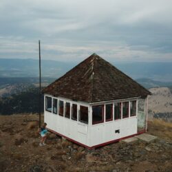
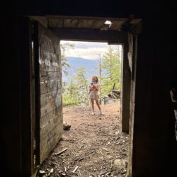
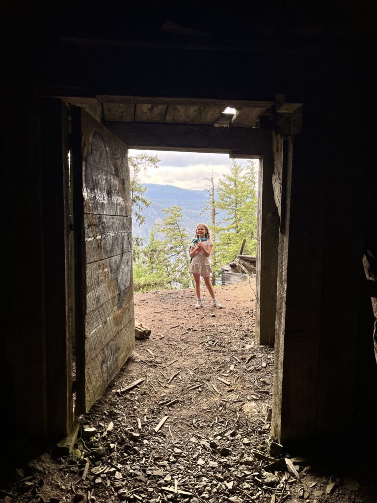
Agate Fire Tower is an abandoned B.C. Forestry Station overlooking the Silmilkameen valley from Agate mountain, not far from Princeton, BC. It was commissioned in 1955 and active every year during the 6 months of the forest fire season. It was eventually abandoned in the 1980s when new technology made having a staffed lookout unfeasible.

There are a number of ways to access Agate Fire Lookout and one route is so well maintained that even 2WD vehicles can make it almost all the way (if not the whole way) to the top. Turn onto Wolf Creek FSR from HWY 3 near Bromley Rock. This is all unpaved road from now on. Follow this until there is an obvious Y intersection and a sign for Agate Road. Follow Agate road until there is a 4 way intersection. Turn right. From here on the road is in rough shape but it is less than a kilometre to the end so it is possible to finish the journey with a short walk if necessary.
There is an alternate route by taking the other road (not Agate Road) at the Y turn. This takes you past a mysterious monitoring station and arrives a different junction on the same 4 way intersection (go straight through intersection for this route). There is another road off of Copper Mountain Road / Willis FSR but this is reported to be in real rough shape (perhaps ATV only).

(adsbygoogle = window.adsbygoogle || []).push({});
Agate Fire Lookout is perched on dramatic cliffs and has some other historical buildings on site including a wood shed and outhouse. All buildings including the lookout tower itself are in the final stages of life. The fire lookout has never been adopted/loved by the local community and has degraded further every year. At the moment there are no windows or door and it might not be long before the tower falls over completely.